Allen's Orchard

Find apples, rows, market stops, restrooms, and event areas.

Use the map during your visit to find your way around the orchard. Browser GPS can get you close; row QR signs provide the exact variety context.

Start at the market

Check in, confirm open rows, and get staff guidance before U-pick.

Picking filters

Show rows and areas by current availability, not just static labels.

Row QR pages

Scan signs for exact row context when GPS is approximate.

Fallback map

Keep a static map available when cellular or map tiles are unreliable.

Visitor overview

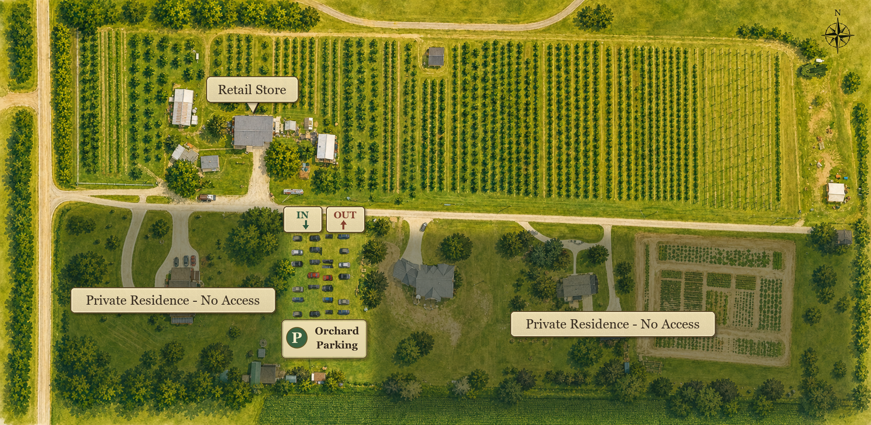
Parking, public orchard, and private property boundaries

Swipe across the map to read labels and parking directions.

Allen's Orchard visitor overview showing orchard rows, the grass parking lot, roads, and shaded private no-access residences

Live orchard map

Satellite rows and guest wayfinding

Backup satellite imagery is shown so the map remains usable.
The traced rows come from detailed aerial imagery. We are confirming numbering, endpoints, and variety assignments before signs are printed.
5801 N 10th St, Marion, IA 52302

Layers

Basemap: Esri World Imagery. Row lines come from Allen's Orchard aerial imagery and remain under review until numbering is confirmed.

Tap locate to request approximate browser GPS. Row QR scans are more exact.